Quito
UIO
Quito Mariscal Sucre International Airport

Ecuador
Departures


Quito Mariscal Sucre International Airport
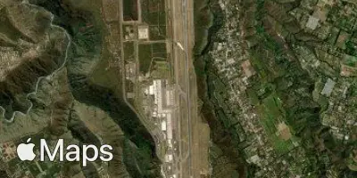
Quito Mariscal Sucre International Airport (UIO) serves the capital city of Ecuador, located about 17 miles from downtown Quito. The airport sits at an elevation of 7,827 feet, making it one of the higher-altitude international airports in the world. This elevation affects aircraft performance, requiring longer takeoff distances and influencing how airlines plan payload and fuel for departing flights.
The airport's high-altitude setting, combined with its position amid the Andes mountain range, means that surrounding terrain and variable mountain weather patterns can play a role in approach and departure conditions. Travelers should be aware that thinner air at this elevation can also affect personal comfort upon arrival, and it is a factor pilots account for when operating in and out of the region.
No route or traffic data is available for this airport in the current dataset, so specific international or domestic connectivity patterns cannot be described here. Travelers flying through Quito Mariscal Sucre International Airport should keep in mind the unique high-altitude environment when planning their journey, as it is a defining characteristic of this airport's operations.
Height above sea level
7827 ft
Distance to city
17 miles
Traffic volume
100 flight per day
Satellite