Mesa
AZA
Phoenix-Mesa Gateway Airport

United States



Arrivals
Phoenix-Mesa Gateway Airport
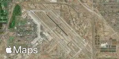
Phoenix-Mesa Gateway Airport (AZA) serves Mesa, Arizona, and lies approximately 20 miles from the city center. The airport sits at an elevation of 1,382 feet, a factor that can influence aircraft performance and approach characteristics, particularly during warmer months typical of the region's climate.
No route information is available for this airport, so its traffic character and connectivity cannot be described in detail here. Travelers should check with airlines operating at Phoenix-Mesa Gateway for specific route networks and scheduling.
Given its distance from downtown Mesa, passengers should plan ground transportation accordingly, allowing sufficient time for the transfer between the airport and the city. The elevation and desert surroundings are typical of airports in the greater Phoenix metropolitan area, and travelers flying into or out of AZA should be prepared for the arid climate and associated conditions common to this part of Arizona.
Height above sea level
1382 ft
Distance to city
20 miles
Traffic volume
120 flight per day
Satellite